Eelgrass Data Quest
Seagrasses are marine flowering plants that play a wide range of important roles in coastal ecosystems. For example, they form meadows that create extensive habitats for marine fish and invertebrates (including lobster, cod, salmon, and eel), they help fight climate change by capturing and storing carbon, and they form shallow banks that help protect our shorelines from storm surge and erosion. Despite their importance, seagrasses are declining around the globe at a rate of about 1-2% per year.
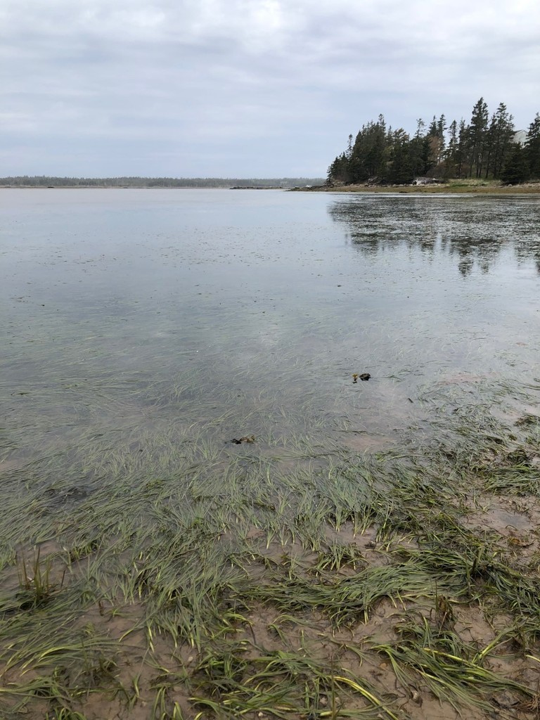
In Canada, eelgrass is a common species of seagrass that fringes much of our shorelines, particularly in shallow, sheltered areas with a sandy or muddy bottom, and occurs in water from the shore out to about 10 m deep. In many cases, eelgrass meadows are exposed to the air at low tide.
Eelgrass is easily identified by its long, bright green and rectangular blades. The blades can range in height from a few cm to 1 m or more! Eelgrass blades also have a distinctive rounded tip. Eelgrass can occur very sporadically (i.e. just a few shoots spread over a given area) or can form large and dense meadows. Unfortunately, we don’t have good maps or observations of eelgrass along with many parts of the coast. This is where you can help as part of the City Nature Challenge! The Ecology Action Centre has prepared two Data Quests for CNC 2022: one for low tide walks and another for paddlers who happen to have an underwater camera.
Data Quest 1: Low tide walks.
Data on eelgrass can be collected by taking a walk on mudflats along the shore when the tide is out, particularly around a full or new moon when the water is particularly low. Can you find live eelgrass growing in the mud in your area? If you can, the best pictures can be taken from the top-down perspective in well-lit conditions. If possible, include a common object in the image like a ruler (best) or pen so that we can get a sense of the size of the plant. If you can pair a close-up image of an eelgrass shoot with a wider photo of the meadow around it, all the better! Make sure that the eelgrass you are photographing is alive (color should be green, not brown) and rooted – we don’t want photos of loose eelgrass blades that have floated in from elsewhere.
Data Quest 2: Paddler Observations
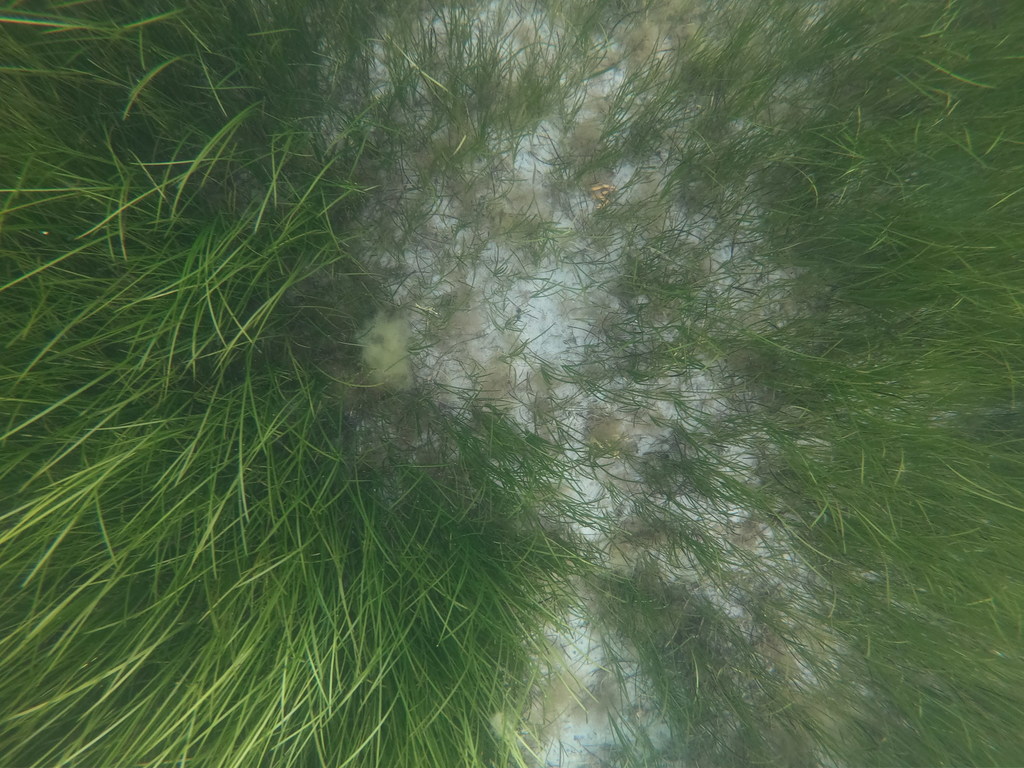
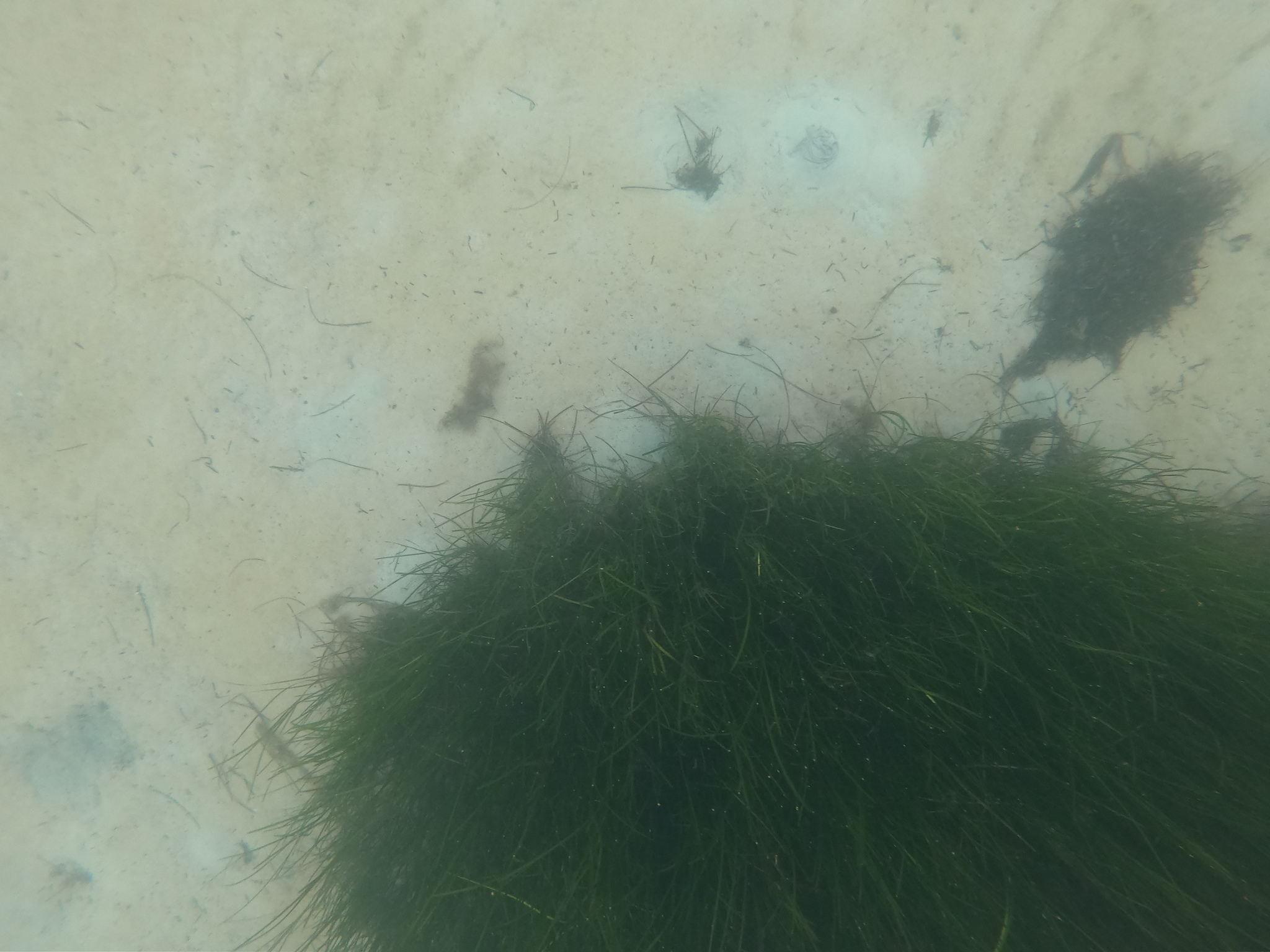
Record eelgrass observations by taking photos of eelgrass in shallow water from a kayak, canoe, or small boat (or while wading). The best photos are taken looking straight down from the surface (see image below) because that will give us a sense of how dense the meadow is (in other words, how much of the bottom is covered). However, if the water is too shallow this may not be possible, in which case a photo taken at an angle will work. Feel free to pair close-up photos with a wider shot of the surrounding meadow to help us get a sense of how dense and large the meadow is. If wading, please take care not to step on and damage eelgrass plants!
Straight down image showing both alive (green) and dead (dark brown) eelgrass


