Understanding Your Privacy Settings for iNaturalist Vermont
Many users don't realize that there are geoprivacy settings found in your user account that dictate not only what the public can see, but also what we can see as project curators on the iNaturalist Vermont project. Geoprivacy is a setting you can make on your observations that controls how the spatial coordinates (latitude and longitude) are displayed. Here are the options:
- open: Everyone can see the coordinates unless the taxon is threatened.
- obscured: Public coordinates shown as a random point within a 0.2 by 0.2 degree area that contains the true coordinates, which works out to about a 22x22 km square area of uncertainty at the equator, decreasing as you approach the poles. True coordinates are only visible to you and the curators of projects to which you add the observation.
- private: Coordinates completely hidden from public maps, true coordinates only visible to you and the curators of projects to which you add the observation.
When coordinates are obscured it means that a random point within a 0.2 degree x 0.2 degree area containing the true coordinates is shown publicly (i.e. on the home page, the observations page, and project pages), while the true coordinates are only visible when you are viewing your own observations (i.e. on the individual project pages and the list of your own observations). Note that curators of the projects to which you've added an observation can also see the true coordinates. Obscured coordinates should always be symbolized by circular marker without stems on maps and in geospatial feeds.
Coordinates are automatically obscured for all taxa that are "NEAR THREATENED" or worse according to the IUCN Red List. Some taxa may be declared threatened according to other conservation authorities, and some may be simply marked as threatened by iNat site curators if they believe it merits protection. You can also obscure the coordinates of your own observations regardless of what the taxon is.
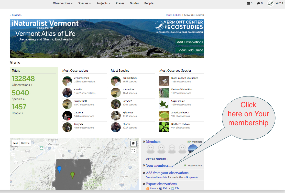
It is important to set your geoprivacy settings so that we can get the most out of your observations for conservation and science. First, go to the iNaturalist Vermont project page at http://www.inaturalist.org/projects/vermont-atlas-of-life. Indicated in the image below, you can see you need to click on "Your membership" to open the project settings.

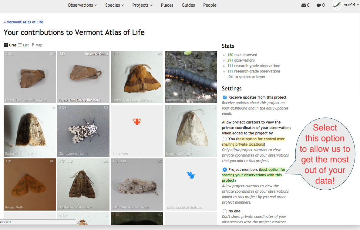
In this new window, on the right side under "Settings", you can select the geoprivacy of your data for our project. The first one is the default. We'd actually prefer that you select the second option, in green, and indicated below in this screen image. This allows us as curators to see the actual location of any data you make private, thereby making it much much more useful for conservation and science applications.

Thank you so much for your contributions and we hope you share as much with us as possible. If you have any questions, please let us know!
Kent McFarland, kmcfarland@vtecostudies.org


Comentarios
Also note that you can do this by individual observation as well. If there's one observation you don't want the location shared with the project, you can mark that one as not shared (using the gear button on the observation page next to the project), and otherwise mark so that all the other ones are shared.
Añade un comentario